Manual for Streets 2
Manual for Streets 2 - Wider Application of the Principles, a companion guide to Manual for Streets, was published by the Chartered Institution of Highways and Transportation in September 2010. The document is endorsed by the Department for Transport, the Homes and Community Agency, the Welsh Assembly Government Commission for Architecture and the Built Environment, the Association of Directors of Environment, Economy, Planning and Transport and English Heritage.
Manual for Streets 2 has been specifically created to help fill a perceived gap in design guidance between Manual for Streets (which focuses on residential streets) and the Design Manual for Roads and Bridges (which is concerned with roads generally outside of the residential environment such as trunk roads and motorways).
Whilst the Design Manual for Roads and Bridges is the design standard for Trunk Roads and Motorways in Great Britain, its application to non-trunk routes is rarely appropriate for highway design in built up areas, regardless of the level of traffic volumes.
Manual for Streets 2 does not supersede Manual for Streets, rather it explains how the principles of Manual for Streets can be applied more widely, exploring in greater detail how and where its key principles can be applied to busier streets and roads both in urban and rural locations up to, but not including, trunk roads.
Manual for Streets 2 builds on the original principles of balancing movement and place status at any particular location by examining common street types in different contexts to demonstrate how context and user needs inform a balanced approach to design.
Manual for Streets 2 provides additional clarification on issues relating to Highway Design, Risk and Liability.
Manual for Streets 2 contains further detailed design guidance on geometric and other parameters for new and improved highways. Although numerical values are given, designers are encouraged to take a flexible approach to their interpretation and application, thinking through for themselves the likely outcome of any course of action based on experience and local circumstances.
In preparing schemes Manual for Streets 2 recommends that designers should consider the layout in totality, including the relationship of the highway to its surroundings, both in urban and rural areas. The highway should not be seen in Isolation or simply as a piece of infrastructure. The best highway designs respect their surroundings – the buildings, open space and pedestrian/cycle routes that pass through them.
Specific guidance is given in Manual for Streets 2 relating to:-
Pedestrian Needs and Footways
Pedestrian routes need to be direct, connected and clutter free following desire lines as closely as possible, including cross junctions.
Walking has been identified as the most important mode of travel at the local level offering the greatest potential to replace short car trips, particularly those under 2 kilometres. The National Planning Policy Framework (NPPF) encourages developments which give priority to pedestrian and cycle movements and have access to high quality public transport facilities.
Walking and pedestrian needs is a primary consideration in the Transport Assessment of new developments when making planning applications and for the development of Travel Plans.
Cycle Facilities
Cyclists should generally be accommodated on the carriageway with direct, barrier free routes which follow desire lines. Junctions should be designed to accommodate cyclists needs.
It is widely considered that cycling has the potential to substitute for short car trips, particularly those under 5km, and form part of a longer journey by public transport.
Cycling is another key issue in assessing the sustainability of a development location in the Transport Assessment and the development of Travel Plans and as previously stated developments which give priority to this mode of transport are to be encouraged under national planning policy.
Bus Facilities
Bus routes and stops form key elements within walk able neighbourhoods. Routes should be direct and reasonably straight. Bus stops should be high-quality places that are safe and comfortable to use and highly accessible by all people.
The availability and use of public transport is a very important ingredient in determining locational policies designed to reduce the need for travel by private car. Local authorities should aim to establish high quality, safe, secure and reliable network of routes, with good interchanges, which matches the pattern of travel demand in order to maximise the potential usage of public transport. NPPF states that developments need to maximise the use of sustainable transport modes which includes public transport.
Manual for Streets identifies measures such as bus priority lanes and bus boarders designed to reduce bus journey times.
The Transport Assessment of new developments will audit available public transport facilities including bus, rail and taxis and recommends mitigation measures where deficiencies in provision are identified.
Manual for Streets builds on national guidelines in identifying that providing good bus services, particularly in urban areas, is fundamental to achieving more sustainable patterns of movement that reduced peoples reliance on the car. This is the primary aim of Travel Plans.
Carriageways
Design speed in urban areas should generally not exceed 30mph (50 kph) and speed limits of 20mph (30 kph) are now becoming commonplace.
Measures to help reduce speeds include:
- Physical features
- Changes in priority
- Street dimensions
- Reduced forward visibility
- Psychology and perception of the environment
In relation to carriageways Manual for Streets promotes initiatives including:-
- Tighter horizontal alignment to reduce vehicle speeds
- Narrower lanes will reduce speeds and require drivers to pull around cyclists
- Central reservations to assist pedestrians and cyclists crossing the carriageway
- Lower kerb heights to assist pedestrian movement particularly for the mobility – impaired and reduce vehicle dominance
Junctions, Crossings and Access
Manual for Streets identifies that junctions are often seen as problem areas and therefore to be minimised. Conversely, junctions can be seen as opportunities for ‘place’ functions. Well designed crossings are of vital importance to the ability of pedestrians and cyclists to move around safely and easily.
Manual for Streets considers the advantages and disadvantages of crossing types (informal, zebra and signalised), junction types (priority, squares, roundabouts and traffic signals), traffic management, one way systems and direct frontage access.
Visibility
Research carried out in the preparation of Manual for Streets indicated that many of the criteria routinely applied in street design are based on questionable or outdated practice. It demonstrated that driver behaviour is not fixed and can be influenced by the surrounding environment. Manual for Streets addresses these points, providing guidance on revised key geometric design criteria to allow streets to be designed as places in their own right whilst still ensuring that road function and safety is maintained.
A key change resulting from the research carried out relates to driver visibility requirements at junctions and bends. In Manual for Streets this is significantly less than presented in previous guidelines. This has subsequently enabled sites to be brought forward which previously were considered deficient in visibility, particularly relating to driver visibility requirements at accesses and junctions.
Manual for Streets 2 presents additional research which supports previous guidance related to junction visibility in Manual for Streets. Based on the research a reduction in visibility below the recommended stopping sight distances will not necessarily lead to a significant accident problem, unless there is already local evidence to the contrary.
At junctions a minor road distance of 2.4m should normally be used in most built up situations, as this represents a reasonable maximum distances between the front of a car and the drivers eye. Longer distances enable drivers to look for gaps as they approach the junction. This increased junction capacity for the minor arm, but it also increases the possibility that drivers on the minor approach will fail to take account of other road users, particularly pedestrians and cyclists.
A minimum minor road distance of 2m may be considered in some slow –speed situations when flows on the minor arm are low, but using this value will mean that the front of some vehicles will protrude slightly into the running carriageway of the major arm, and many drivers will tend to cautiously nose out into traffic. The ability of drivers and cyclists to see this overhang from reasonable distance, and to manoeuvre around it without undue difficulty, should be considered. This also applies to lightly – trafficked rural lanes.
Visibility and the safety of vulnerable road users is a key consideration in Road Safety Audits.
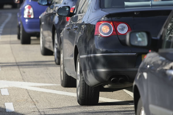
On-street Parking and Servicing
On-street car parking can be a vital component of highways, particularly where routes pass through town or centres and commercial areas. The decision whether or not to provide on-street car parking should take into account its positive and negative effects which are summarised in Manual for Streets as:
Positive Effects
- Common resource, efficient and popular;
- Caters for varying demand and users;
- Adds street activity;
- Typically well overlooked, providing increased security;
- Can provide a useful buffer between pedestrians and traffic.
Negative Effects
- It can introduce road safety problems for pedestrians crossing between parked cars;
- Can be visually dominant;
- Can lead to indiscriminate parking on footways and blocking vehicular entrances;
- On-street parking can lead to opportunistic crime;
- Parking bays take up valuable space which could be better used.
Street Furniture and Trees
Street Furniture is the collective term for the wide range of extraneous items that are placed in highways. In recent years there has been increasing concern that excessive and poorly-planned and maintained street furniture is seriously degrading the quality of the local environment.
Manual for Streets advocates that the design process should start with no street furniture and to introduce only elements which are necessary. Street furniture elements should be combined together where possible and arranged to keep pedestrian routes clutter free and clear.
Traffic Signs and Markings
Traffic signs and markings add significantly to the amount of street furniture. Manual for Streets identifies opportunities to reduce excessive signing, where this would not have a detrimental impact on road safety. Manual for Streets provides examples of where this could be done, whilst complying with the legal requirements of the Traffic Signs Regulations and General Direction and other Regulations.
What is particularly useful in Manual for Streets 2 are the detailed case studies which show recent good examples of schemes incorporating principles of Manual for Streets.
A key principle of Manual for Streets is that most Manual for Streets advice can be applied to a highway regardless of speed limit. It is therefore recommended within Manual for Streets 2 that as a starting point for any scheme affecting non trunk roads, designers should start with Manual for Streets. This approach demonstrates that the key Manual for Streets principles can be applied widely to improve the quality of highways and their application is not limited to low speed or lightly trafficked routes.
When applying the principles of Manual for Streets to busy urban and rural environments with speeds in excess of 40mph, Manual for Streets 2 places emphasis on local context in determining whether the principles of Manual for Streets apply. This is likely to be subjective but the guidance clearly identifies the potential to apply the application of the Manual for Streets principles to the wider highway network.
Manual for Streets 2 provides advice whilst not setting out any policy or legal requirements, and, it is set to form additional guidelines (in conjunction with Manual for Streets) by which Local Planning and Highway Authorities will be expected to consider the highway aspects of planning applications.
As Manual for Streets 2 - Wider Application of the Principles, a companion guide to Manual for Streets, was published by the Chartered Institution of Highways and Transportation then a free download is not available, a copy may be purchased from the Chartered Institution of Highways and Transportation website.
What Our Clients Say:
Swept Path Analysis and Visibility Drawing incorporated into a Technical Note, Proposed Residential Dwelling, Colchester.
Highway Statement, Proposed Residential Development, Stockport
Transport Assessment, Proposed Residential Development (170 dwellings), Essex
Speed Survey, Proposed Private Residential Development – Testimonial
Access Feasibility Study, Proposed Private Residential Development – Testimonial
Analysis of Speed Survey and Swept Path Analysis
Stage 2 Road Safety Audit, Residential, Staffordshire
Construction Traffic Management Plan
Flood Risk Assessment, Testimonial, Industrial Development, Sheffield
Travel Plan
Require Assistance with a Highway Planning Matters?
Sanderson Associates have enjoyed over 37 years in business, our experienced engineers have extensive experience in assisting our Clients with Highway Planning Matters for a wide variety of major and minor developments throughout the whole of the UK, Isle of Man and Ireland.
We would be pleased to provide you with our competitive fee proposal to assist you with any Highway Planning Matters, please call us on 01924 844080 or click here to complete our secure online form.